NOTE: While the Agrology Fire Map provides valuable information needed to take action, it is meant for growers who want to plan actions for their teams, and not as a life-saving tool.
Introducing the Agrology Fire Map
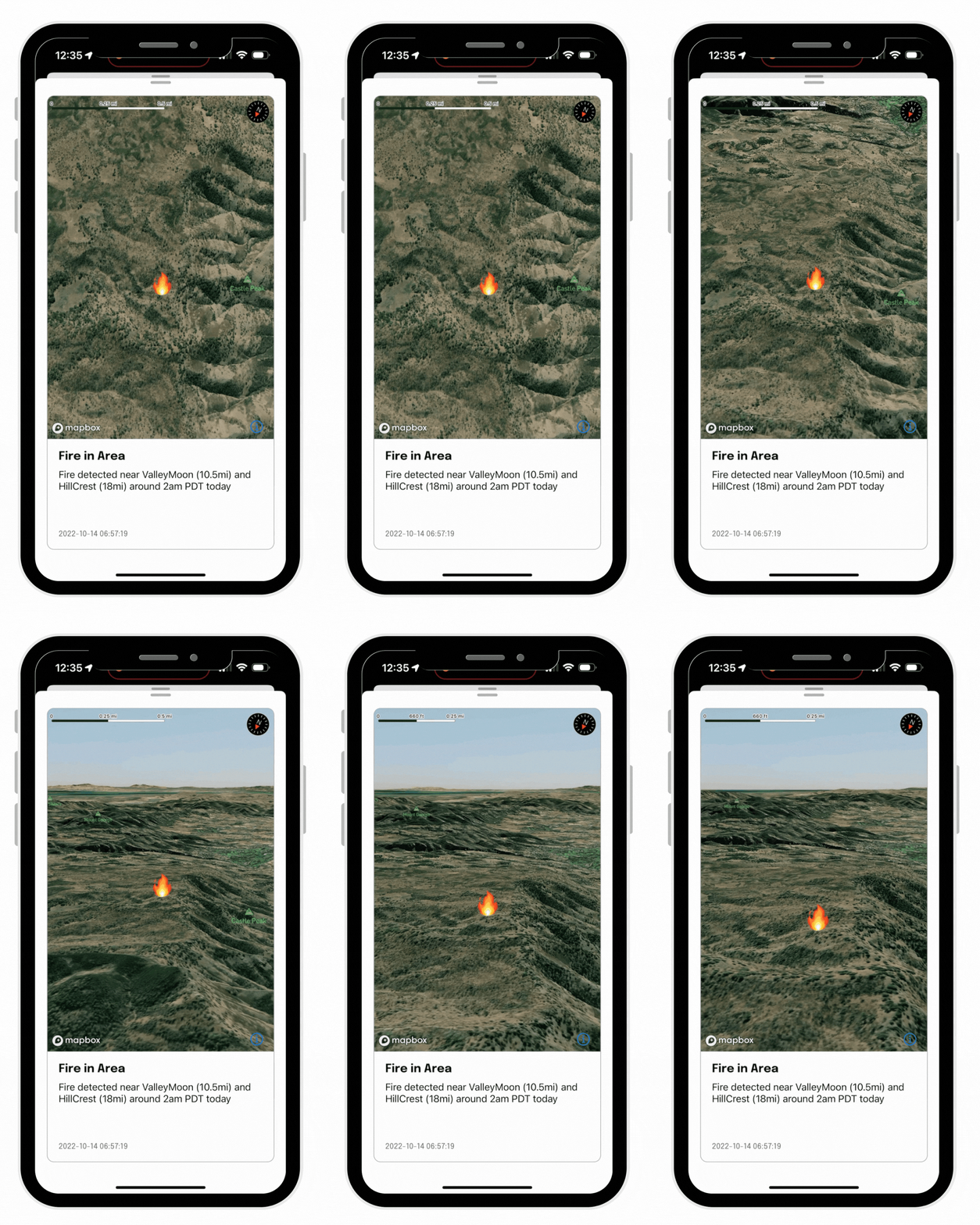
Available for free in the Agrology iOS app, the Agrology Fire Map enables growers to monitor active fires within a 20-mile radius of any location in the world.
Get access to:
Zoom in and out to see the exact location of fires
Select up to three locations to track at once
Real-time fire alerts (paid subscribers only)
“As a Sonoma-county grower, I am extremely worried about the effects of wildfires and over the past several growing seasons Agrology has enabled me to take quick action when fires break out. I use the Agrology app daily and during fire season I find the Fire Map feature incredibly useful and actionable. I can pinpoint exactly where the threat is coming from and plan accordingly.” - Riggs Lokka, Emeritus Vineyards.
Protect Your Crops from Wildfires - Upgrade to the Sentinel System
While the Fire Map is free for anyone to use, growers can expand their preparedness for fire season by subscribing to and installing the Agrology Sentinel Climate Monitoring System.
This machine-learning based system monitors VOCs, fine particulate matter, wind speed, and more–all in real time. Subscriptions start at around $375 per month and include installation, as well as all hardware and software updates, eliminating the need for growers to invest in expensive hardware.
All in real time.
Wildfires Pose an Existential Threat to Farming.
You can fight back.
Monitor Threats from the Palm of Your Hand.
After the devastating wildfires of 2020, we rolled up our sleeves to help. Agrology developed the technology to track the wildfire smoke chemicals that cause smoke taint. This enabled viticulturists to receive wildfire alerts, monitor smoke impact in real time, and keep crops and teams safe.
With Agrology You Can:
Measure:
Volatile Organic Compounds (VOC chemicals that cause smoke taint)
Fine Particles
Extreme Weather Events
Predict:
Machine learning (ML) technology predicts impacted blocks.
Our mobile app alerts you when a problem is predicted.
Report:
Rather than waiting months for results from overstretched labs, access smoke exposure data in real time.
Protect crops and employees, and inform your workflows.
Get a clear picture with our data reports. For an example, download the 2021 Agrology Smoke Exposure Report here.
It’s No Longer Business as Usual. That’s Why We’re Here to Help.
Each year wildfires ravage farms and vineyards in the United States. The future of farming requires a new way to handle threats.
Agrology gives you predictions and insights in real time, empowering you to act immediately and overcome the threat.
Predict & Mitigate Threats.
Climate Change. Drought. Wildfires. Extreme Weather.
We are the only solution that innovates fast enough to keep up.


